File:St Michael's church - carved bench end - geograph.org.uk - 1362349.jpg
Size of this preview: 450 × 600 pixels. Other resolutions: 180 × 240 pixels | 480 × 640 pixels.
Original file (480 × 640 pixels, file size: 87 KB, MIME type: image/jpeg)
This is a file from the Wikimedia Commons. Information from its description page there is shown below.
Commons is a freely licensed media file repository. You can help. |
Summary
| Description |
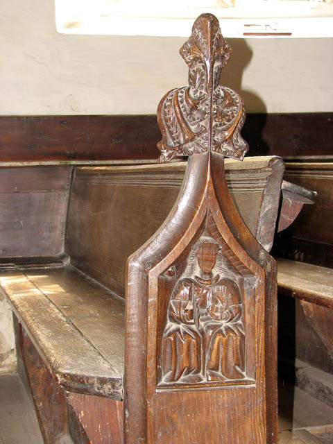
English: St Michael's church - carved bench end. St Michael's church > 1362320 - 1362341 - 1362362 is set back from the main road, the A140, leading into Long Stratton. The church has an early C14 chancel which is in one with the nave but the roof line changes where the rood screen used to be. The benches have poppyheads, and seated figures have been carved into the ends of two of them. The octagonal font > 1362367 dates from the 15th century and some of the windows contain fragments of medieval glass > 1362352. This church is open every day. |
| Date | |
| Source | From geograph.org.uk |
| Author | Evelyn Simak |
| Attribution (required by the license) | Evelyn Simak / St Michael's church - carved bench end / |
| Camera location | | View this and other nearby images on: OpenStreetMap |
|---|
_heading:180.00&language=en)
| Object location | | View this and other nearby images on: OpenStreetMap |
|---|
_heading:180.00&language=en)
Licensing

|
This image was taken from the Geograph project collection. See this photograph's page on the Geograph website for the photographer's contact details. The copyright on this image is owned by Evelyn Simak and is licensed for reuse under the Creative Commons Attribution-ShareAlike 2.0 license.
|
This file is licensed under the Creative Commons Attribution-Share Alike 2.0 Generic license.
Attribution: Evelyn Simak
- You are free:
- to share – to copy, distribute and transmit the work
- to remix – to adapt the work
- Under the following conditions:
- attribution – You must give appropriate credit, provide a link to the license, and indicate if changes were made. You may do so in any reasonable manner, but not in any way that suggests the licensor endorses you or your use.
- share alike – If you remix, transform, or build upon the material, you must distribute your contributions under the same or compatible license as the original.
File history
Click on a date/time to view the file as it appeared at that time.
| Date/Time | Thumbnail | Dimensions | User | Comment | |
|---|---|---|---|---|---|
| current | 12:27, 28 February 2011 | | 480 × 640 (87 KB) | GeographBot | == {{int:filedesc}} == {{Information |description={{en|1=St Michael's church - carved bench end St Michael's church > http://www.geograph.org.uk/photo/1362320 - http://www.geograph.org.uk/photo/1362341 - http://www.geograph.org.uk/photo/1362362 is set bac |
File usage
The following page uses this file: