File:Tatry NASA World Wind.jpg
Size of this preview: 800 × 569 pixels. Other resolutions: 320 × 228 pixels | 640 × 455 pixels | 1,024 × 728 pixels.
Original file (1,024 × 728 pixels, file size: 154 KB, MIME type: image/jpeg)
This is a file from the Wikimedia Commons. Information from its description page there is shown below.
Commons is a freely licensed media file repository. You can help. |
Summary
| Description |
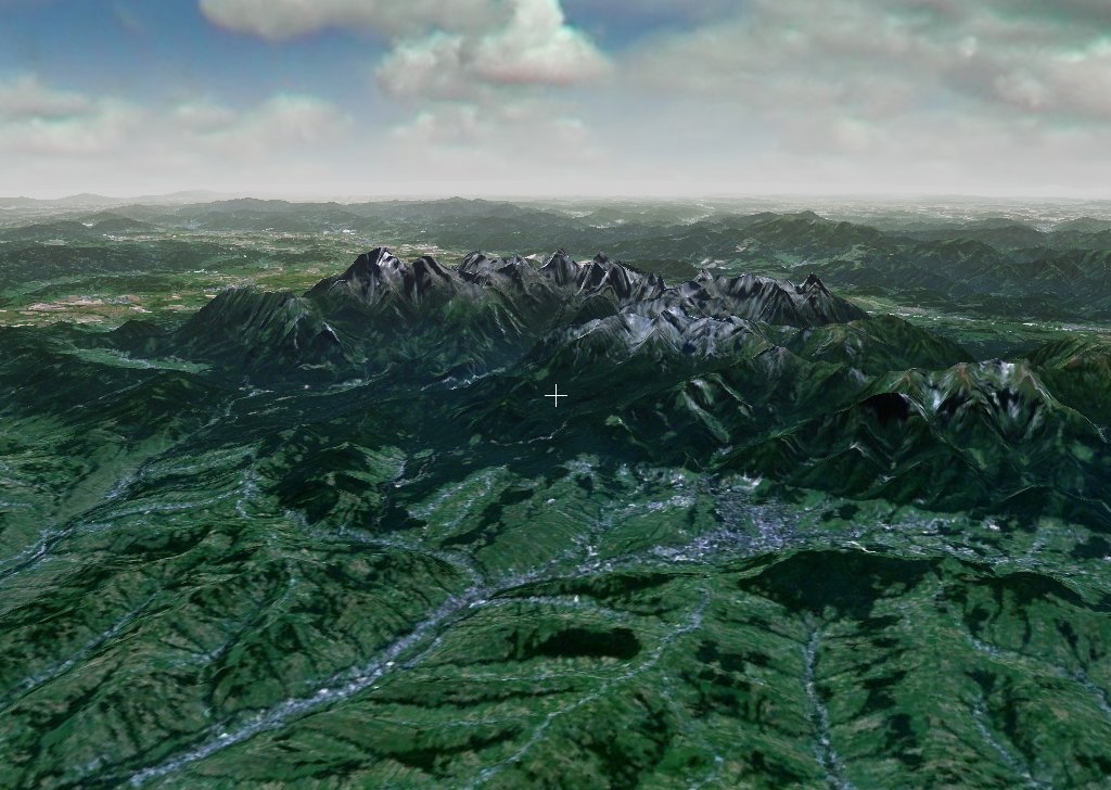
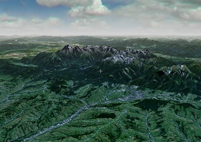
Polski: NASA World Wind - widok na pl:Tatry i pl:Zakopane (NLT Landsat Visible)
(chmury i mgła widoczne dzięki zastosowaniu pluginu [1]) |
| Date | 22 October 2005 (original upload date) |
| Source | NASA World Wind (Transferred from pl.wikipedia to Commons.) |
| Author | The original uploader was Mk at Polish Wikipedia. |
Licensing
| This image is in the public domain because it is a screenshot from NASA’s globe software World Wind using a public domain layer, such as Blue Marble, MODIS, Landsat, SRTM, USGS or GLOBE.
|
 |
Original upload log
The original description page was here. All following user names refer to pl.wikipedia.
- 2005-10-22 16:16 Mk 1024×728× (157707 bytes) [[NASA World Wind]] - widok na [[Tatry]] i [[Zakopane]] (NLT Landsat Visible) (chmury i mgła widoczne dzieki zastosowaniu pluginu [http://www.worldwindcentral.com/wiki/Add-on:Sky_and_Fog_Plug-ins_(plugin)]
- 2004-12-10 15:28 Mk 1024×674× (107659 bytes) Tatry - widok w programie World Wind
File history
Click on a date/time to view the file as it appeared at that time.
| Date/Time | Thumbnail | Dimensions | User | Comment | |
|---|---|---|---|---|---|
| current | 00:02, 18 March 2009 | | 1,024 × 728 (154 KB) | Karol007 | {{Information |Description={{pl|NASA World Wind - widok na pl:Tatry i pl:Zakopane (NLT Landsat Visible) (chmury i mgła widoczne dzięki zastosowaniu pluginu [http://www.worldwindcentral.com/wiki/Add-on:Sky_and_Fog_Plug-i |
File usage
The following page uses this file:
Global file usage
The following other wikis use this file:
- Usage on pl.wikipedia.org
- Usage on vi.wikipedia.org
- Usage on zh.wikipedia.org
- Usage on zh.wiktionary.org