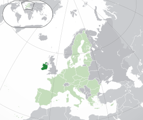
File:EU-Ireland.svg

Size of this PNG preview of this SVG file: 713 × 600 pixels. Other resolutions: 285 × 240 pixels | 571 × 480 pixels | 913 × 768 pixels | 1,218 × 1,024 pixels | 2,435 × 2,048 pixels | 2,045 × 1,720 pixels.
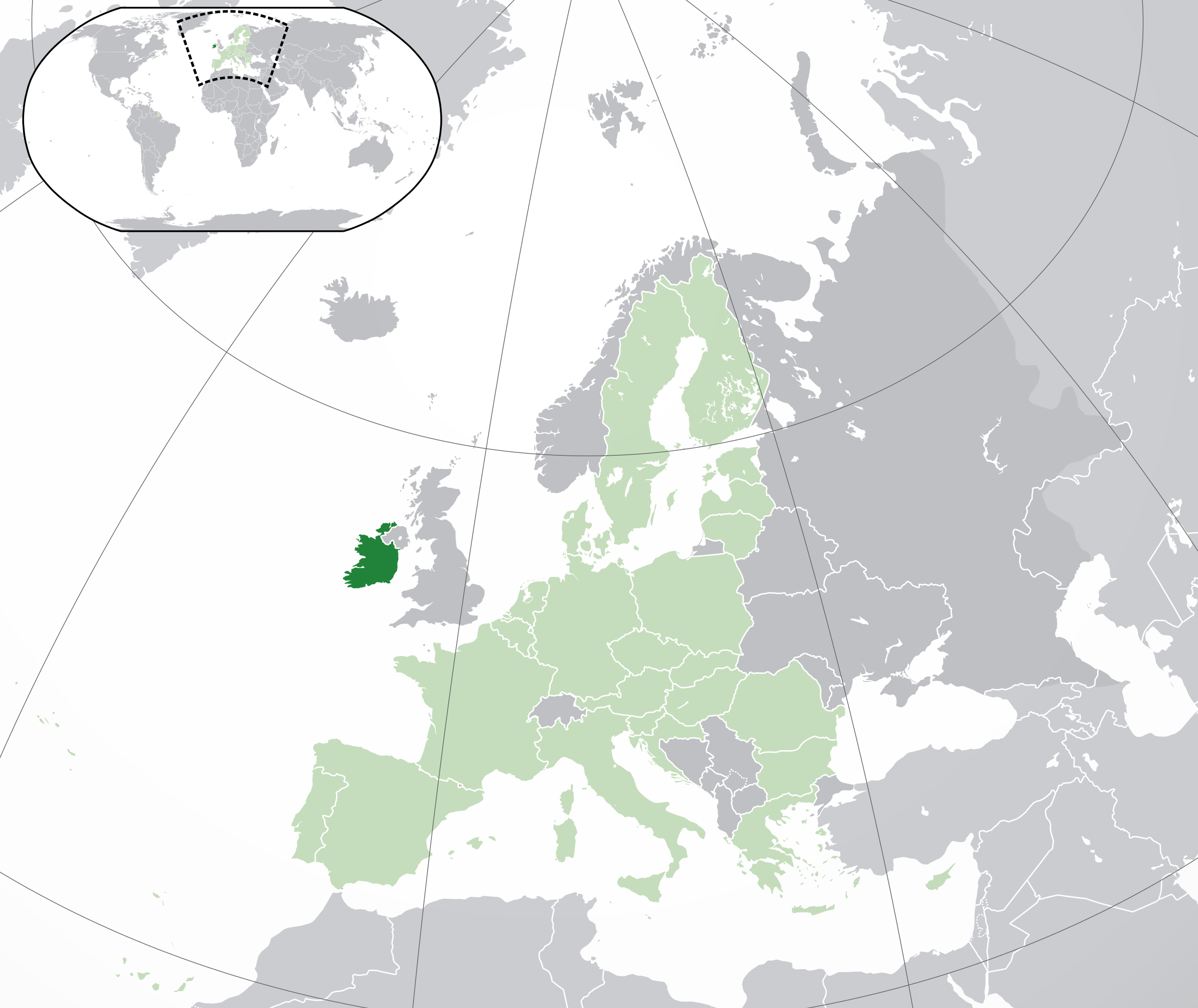
Original file (SVG file, nominally 2,045 × 1,720 pixels, file size: 7.33 MB)
File history
Click on a date/time to view the file as it appeared at that time.
| Date/Time | Thumbnail | Dimensions | User | Comment | |
|---|---|---|---|---|---|
| current | 05:03, 1 February 2020 | | 2,045 × 1,720 (7.33 MB) | Rob984 | UK and Gibraltar have left the EU. New base which includes all of Portugal's islands within frame, as well as Arctic Russian islands part of Europe. Also fixed Flevoland in the Netherlands. |
| 20:31, 25 October 2016 |  | 2,045 × 1,720 (7.32 MB) | Giorgi Balakhadze | Rv of sockpuppet and per COM:OVERWRITE | |
| 15:59, 18 March 2015 |  | 2,045 × 1,720 (7.38 MB) | Mapclean | Reverted to Leftcry's version, please go to your talk page | |
| 14:07, 21 February 2015 |  | 2,045 × 1,720 (2.62 MB) | VS6507 | Spain. Greece. Slovakia. Cyprus. Romania VETO | |
| 19:37, 16 November 2014 |  | 2,045 × 1,720 (7.38 MB) | Leftcry | Reverted to version as of 15:40, 6 August 2014 Please go to your talk page | |
| 16:34, 16 November 2014 |  | 2,045 × 1,720 (2.62 MB) | A2D2 | The map must show the original de-jure status with no breakaway regions, as it was originally created. An alternative map showing the de-facto status with breakaway regions needs to be created instead. | |
| 15:48, 16 November 2014 |  | 2,045 × 1,720 (7.38 MB) | A2D2 | Reverted to version as of 10:27, 13 July 2014 | |
| 15:40, 6 August 2014 |  | 2,045 × 1,720 (7.38 MB) | Rob984 | Sudan | |
| 10:27, 13 July 2014 |  | 2,045 × 1,720 (7.38 MB) | Rob984 | More accurate coastline, borders, etc. Slightly different centre point. Added gradient and longitude and latitude lines. Otherwise it's difficult to tell what kind of projection this is and therefore potentially misleading. | |
| 09:14, 1 July 2013 |  | 2,045 × 1,720 (2.62 MB) | U5K0 | croatia |
File usage
The following page uses this file:
Global file usage
The following other wikis use this file:
- Usage on ady.wikipedia.org
- Usage on af.wikipedia.org
- Usage on ami.wikipedia.org
- Usage on ar.wikipedia.org
- جمهورية أيرلندا
- مستخدم:ElWaliElAlaoui/ملعب 8
- معاملة المثليين في جمهورية أيرلندا
- العلاقات الأنغولية الأيرلندية
- العلاقات الأيرلندية الكورية الجنوبية
- العلاقات الإريترية الأيرلندية
- العلاقات الأيرلندية السويسرية
- العلاقات الألمانية الأيرلندية
- العلاقات الأيرلندية الليختنشتانية
- العلاقات البوليفية الأيرلندية
- العلاقات الأيرلندية الموزمبيقية
- العلاقات الألبانية الأيرلندية
- العلاقات البلجيكية الأيرلندية
- العلاقات الإثيوبية الأيرلندية
- العلاقات الأيرلندية البيلاروسية
- العلاقات الأيرلندية الطاجيكستانية
- العلاقات الأيرلندية الروسية
- العلاقات الأيرلندية الرومانية
- العلاقات الأرجنتينية الأيرلندية
- العلاقات الأيرلندية الغامبية
- العلاقات الأيرلندية القبرصية
- العلاقات الأيرلندية السيراليونية
- العلاقات الأيرلندية النيبالية
- العلاقات الأيرلندية الليبيرية
- العلاقات التشيكية الأيرلندية
- العلاقات الأيرلندية الميانمارية
- العلاقات السعودية الأيرلندية
- العلاقات الأيرلندية الكندية
- العلاقات الأيرلندية الزيمبابوية
- العلاقات الإسرائيلية الأيرلندية
- العلاقات البالاوية الأيرلندية
- العلاقات الأيرلندية المالية
- العلاقات الأيرلندية النيجيرية
- العلاقات اليمنية الأيرلندية
- العلاقات الأيرلندية الفانواتية
- العلاقات الغابونية الأيرلندية
- العلاقات البنمية الأيرلندية
- العلاقات الأيرلندية الكوبية
- العلاقات الأيرلندية الجورجية
- العلاقات التونسية الأيرلندية
- العلاقات الأيرلندية الكورية الشمالية
- العلاقات الهندية الأيرلندية
- العلاقات الإيطالية الأيرلندية
- العلاقات الأيرلندية الناوروية
- العلاقات الأسترالية الأيرلندية
- العلاقات الأيرلندية الزامبية
View more global usage of this file.