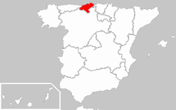
File:Locator map of Cantabria.png
Locator_map_of_Cantabria.png (250 × 157 pixels, file size: 5 KB, MIME type: image/png)
File history
Click on a date/time to view the file as it appeared at that time.
| Date/Time | Thumbnail | Dimensions | User | Comment | |
|---|---|---|---|---|---|
| current | 23:18, 25 December 2009 |  | 250 × 157 (5 KB) | Martin H. | Reverted to version as of 20:06, 8 March 2005 |
| 15:47, 25 December 2009 |  | 250 × 189 (27 KB) | Vegggggggggggggg | {{Information |Description={{es|1=.}} |Source=. |Author=. |Date=. |Permission= |other_versions= }} | |
| 20:06, 8 March 2005 |  | 250 × 157 (5 KB) | Richie | replaced map because it contained gamma correction leading to different background colour in different browsers | |
| 19:06, 23 December 2004 |  | 250 × 157 (10 KB) | David Legrand |
File usage
The following page uses this file:
Global file usage
The following other wikis use this file:
- Usage on be.wikipedia.org
- Usage on bs.wikipedia.org
- Usage on de.wikipedia.org
- Usage on de.wiktionary.org
- Usage on eo.wiktionary.org
- Usage on es.wikipedia.org
- Usage on fa.wikipedia.org
- Usage on frp.wikipedia.org
- Usage on fr.wiktionary.org
- Usage on hr.wikipedia.org
- Usage on hu.wikipedia.org
- Usage on ka.wikipedia.org
- Usage on kw.wikipedia.org
- Usage on la.wiktionary.org
- Usage on oc.wikipedia.org
- Santandèr
- Vath de Vilaverda
- Castro-Urdiales
- Santillana del Mar
- Rionansa
- Valdáliga
- Polaciones
- Ribamontán al Monte
- Ribamontán al Mar
- Modèl:Comunas de Cantàbria
- Alfoz de Lloredo
- Ampuero
- Anievas
- Arenas de Iguña
- Argoños
- Arnuero
- Arredondo
- El Astillero
- Bárcena de Cicero
- Bárcena de Pie de Concha
- Bareyo
- Cabezón de la Sal
- Cabezón de Liébana
- Cabuérniga
- Camaleño
- Camargo
- Campoo de Enmedio
- Campoo de Yuso
- Cartes
- Castañeda
- Cieza (Cantàbria)
- Cillorigo de Liébana
- Colindres
- Comillas
View more global usage of this file.

