File:Mer Baltique.png
Size of this preview: 612 × 600 pixels. Other resolutions: 245 × 240 pixels | 490 × 480 pixels | 784 × 768 pixels | 1,209 × 1,185 pixels.
Original file (1,209 × 1,185 pixels, file size: 79 KB, MIME type: image/png)
This is a file from the Wikimedia Commons. Information from its description page there is shown below.
Commons is a freely licensed media file repository. You can help. |
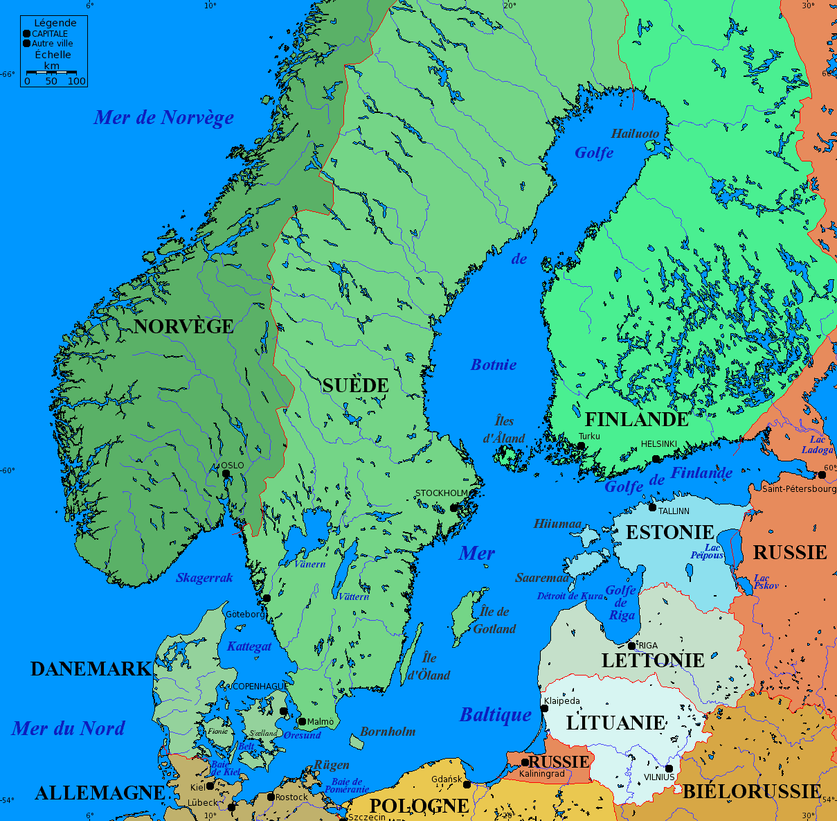
- Nom : Carte de la mer Baltique
- Description :
- Carte de la mer Baltique, et des villes principales alentours.
- Projection de Mercator.
- Données de 2005.
- Les pays à dominante verte sont les pays scandinaves
- En vert plus foncé figurent les pays de la péninsule scandinave : Norvège et Suède
- En vert plus clair figurent le Danemark et la Finlande
- Les pays à dominante bleue sont les pays baltes : Estonie, Lituanie et Lettonie
- Les autres pays sont dans des couleurs diverses : Russie, Pologne, Allemagne et Biélorussie
- Les pays à dominante verte sont les pays scandinaves
- Assemblage de fonds de carte nus provenant de www.aquarius.geomar.de archive copy at the Wayback Machine.
Sous licence GFDL.

|
Permission is granted to copy, distribute and/or modify this document under the terms of the GNU Free Documentation License, Version 1.2 or any later version published by the Free Software Foundation; with no Invariant Sections, no Front-Cover Texts, and no Back-Cover Texts. A copy of the license is included in the section entitled GNU Free Documentation License. |
| This file is licensed under the Creative Commons Attribution-Share Alike 3.0 Unported license. | ||
| ||
| This licensing tag was added to this file as part of the GFDL licensing update. |
Copyright © 2005-06-03 Idarvol

|
This map image could be re-created using vector graphics as an SVG file. This has several advantages; see Commons:Media for cleanup for more information. If an SVG form of this image is available, please upload it and afterwards replace this template with
{{vector version available|new image name}}.
It is recommended to name the SVG file “Mer Baltique.svg”—then the template Vector version available (or Vva) does not need the new image name parameter. |
File history
Click on a date/time to view the file as it appeared at that time.
| Date/Time | Thumbnail | Dimensions | User | Comment | |
|---|---|---|---|---|---|
| current | 04:03, 5 October 2007 | | 1,209 × 1,185 (79 KB) | Tene~commonswiki | Optimised with PNGOUT (0;r) |
| 20:30, 4 July 2005 |  | 1,209 × 1,185 (91 KB) | Idarvol | Optimisée | |
| 19:33, 3 June 2005 |  | 1,209 × 1,185 (249 KB) | Idarvol | Carte de la Mer baltique, et des villes principales alentours. |
File usage
The following page uses this file:
Global file usage
The following other wikis use this file:
- Usage on frp.wikipedia.org
- Usage on fr.wikipedia.org
- Usage on fr.wiktionary.org
- Usage on lb.wikipedia.org
- Usage on mg.wikipedia.org
- Usage on sr.wikipedia.org
- Usage on zh.wiktionary.org