File:Carte du Léman.png
Size of this preview: 800 × 454 pixels. Other resolutions: 320 × 181 pixels | 640 × 363 pixels | 864 × 490 pixels.
Original file (864 × 490 pixels, file size: 21 KB, MIME type: image/png)
This is a file from the Wikimedia Commons. Information from its description page there is shown below.
Commons is a freely licensed media file repository. You can help. |
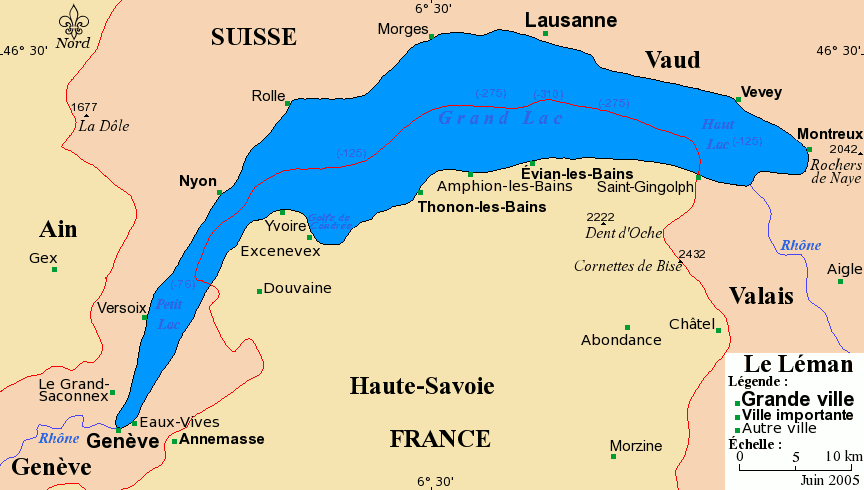
Carte du Léman avec ses villes principales.
Projection de Mercator
Fond de carte provenant de www.aquarius.geomar.de archive copy at the Wayback Machine.
Sous licence GFDL.
- Permission vous est donnée de copier, distribuer et/ou modifier ce document selon les termes de la Licence GNU Free Documentation License, Version 1.2 ou ultérieure publiée par la Free Software Foundation ; sans sections inaltérables ; sans texte de première page de couverture ; sans texte de dernière page de couverture. Une copie de cette Licence est incluse dans la section appelée GNU Free Documentation License de ce document.

|
Permission is granted to copy, distribute and/or modify this document under the terms of the GNU Free Documentation License, Version 1.2 or any later version published by the Free Software Foundation; with no Invariant Sections, no Front-Cover Texts, and no Back-Cover Texts. A copy of the license is included in the section entitled GNU Free Documentation License. |
| This file is licensed under the Creative Commons Attribution-Share Alike 3.0 Unported license. | ||
| ||
| This licensing tag was added to this file as part of the GFDL licensing update. |

|
This map image could be re-created using vector graphics as an SVG file. This has several advantages; see Commons:Media for cleanup for more information. If an SVG form of this image is available, please upload it and afterwards replace this template with
{{vector version available|new image name}}.
It is recommended to name the SVG file “Carte du Léman.svg”—then the template Vector version available (or Vva) does not need the new image name parameter. |
Copyright © juin 2005 Bra
File history
Click on a date/time to view the file as it appeared at that time.
| Date/Time | Thumbnail | Dimensions | User | Comment | |
|---|---|---|---|---|---|
| current | 20:18, 4 July 2005 | | 864 × 490 (21 KB) | Idarvol | optimisée |
| 10:04, 12 June 2005 |  | 864 × 490 (83 KB) | Idarvol | Carte du Léman avec ses villes principales. |
File usage
The following page uses this file:
Global file usage
The following other wikis use this file:
- Usage on de.wikipedia.org
- Usage on fr.wikipedia.org
- Usage on it.wikipedia.org
- Usage on it.wikibooks.org
- Usage on mr.wikipedia.org